Pages

Saturday 7 December 2013

Walking with children

As I've just had a baby, well my wife did, my thoughts have turned to the practicality of walking with children (more specifically babies) pretty swiftly.

Seemingly they can only be carried in a baby carrier when they are around six months old or when they can hold their head up so we've got a few months to wait yet.

I reckon the key to this is comfort, obviously, as there is going to wind up with a fair amount of weight in there and for me to trudge any distance it's got to be a decent fit.

My brother bought one recently and was going to hit the hiking trail with the children for exercise but it didn't really happen. So he is kindly going to lend me his, although I'm not sure exactly what it is yet. It doesn't matter what it is I suppose so long as it's comfy for me and the baby. Then some flat walking, probably continuing along the Leeds Country Way as it's conveniently so close to home. Can't wait to get back outside.

Sunday 15 September 2013

The search for pants...

That's in the American sense of the word pants - like trousers. I've had two pairs of Craghoppers Kiwi convertible trousers which have been worn to death (well I've attempted to but against all odds they've survived - they've been indestructible). They have stood the test of time so have proved that they are great value for money in that regard. After a recent spell of Munro Bagging however I was a bit frustrated in the drag against my legs when they got wet, one time through inclement weather (driving rain) and the other from sweat (nice). So now I am on the hunt for some trousers that don't suffer the same fate when they get moist and glide, rather than stick! I expect these wont come at the same bargain basement price as the Craghoppers Kiwi trousers but that's a price I'm prepared to pay (never has a phrase been so suitable).

Monday 12 August 2013

A review of the Oxfam Trailtrekker - part 3

Now on painkillers we left for Conistone. I was in absolute agony here the blister I'd just treated on my right heel was killing me and my boot was rubbing on my left ankle. My stomach was still playing silly devils and my knee was giving me grief. I figured that we had about 7 hours to go if all went well, then it would all be over. The only saving grace that I didn't have to concern myself with chafing.

The light was just coming back here but it was still absolutely freezing, even with all the layers on with mittens and hat I couldn't get warm and we were some way into this section before I finally shed a layer.

It was also on this section of the hiking trail where questions were asked about the feasibility of completing. I'd stopped for a second and when I caught up with the other two guys they divulged that they thought they didn't have sufficient in the tank for another 30k's, I advised I'd come too far to sack it so I was going to plough on - likely with another team for safety reasons. One of the guys accepted the challenge and said he was with me. Dave was looking greener and greener by the minute. Not long later there was a tent giving warm punch laid on by Oxfam Trailtrekker, there was a steward here and a girl who was retiring. Dave took the opportunity and gracefully bowed out. Gutting that one of the blokes you've come so far with and has endured so much with you isn't able to continue with you. He was completely shot and had absolutely nothing left in him, he was hallucinating and didn't have the energy to keep his head upright any more. He later admitted he thought it was down to the fact he'd not eaten enough. We gave him a hug and left him in capable hands.

We headed through Kettlewell and on to Conistone. Our support team met us again, we weren't there long. We'd sacked off food now and were relying on dextro tablets, Kendal mint cake, lucozade sport and nurofen. I figured that we wouldn't have time to digest the food for it to work, plus I was so bored of eating. We just troughed sugar and high/fast energy stuffs to drive us on.

We were now only 21.5kms from home. I thought this wasn't far, I would normally not even be feeling any fatigue on this but after 80kms its a bit of a different matter. The climb out of Conistone was not an easy one either, well not at this stage in the game. Now every step was excruciating. I'd not changed my socks at the last stop thinking I could endure 20kms from here, after all it wasn't far, what an error. My feet felt massively bruised on the soles and the blisters were biting badly, the failure in my quest to prevent blisters was overwhelming. It was now a case of one foot in front of the other, I kept saying "inching ever closer" repeatedly to myself. This was fast becoming the most painful thing I'd ever done in my life. At the top of here the path leads you over moorland which was mud that had dried to be like uneven concrete which again isn't great for the soles of your feet. About halfway over the moorland though there is a section of about 100 metres of road. There was an ice cream man here giving all the Trailtrekker participants an ice cream, a great touch.

On the next section we were talking to some guys, I divulged the pain I was going through, they suggested I change my shoes, I told them I'd gone light and didn't have any, so they suggested socks, again - I'd gone light and didn't have any, one of the guys offered me a pair or his. My team mate had a pair which he let me use, this eased the pain and onwards we went. It was a nice gesture of the other chap though underlining the feeling of camaraderie that runs through all participants of the event. Before long we were onto the stretch into Hetton and the temperature was starting to soar as the sun was high in the sky.

It was uneven underfoot and was sore, I think the softest of marshmallows would have been met with a wince at this stage. The road into Hetton was like a Roman road and was as straight as a dye for as far as the eye can see, which wasn't great for morale, I found the best way to deal with it was to look at the floor as I trudged on.

At the end of this straight we turned right into Hetton and walked to the church where the water stop had been set up for us. I was running out of steam at 90 miles an hour now but this was the time to dig deep and find the resolve to get to the end, it was no distance now (comparatively) to get to the finish line.

The Oxfam Trailtrekker crew were amazing here though, they were all very chatty about nothing in particular trying to keep us all buoyant. As soon as we arrived they told us to sit down and take a load off our feet and asked us what we wanted. I asked for a coffee and a juice which were in my hands in no time, shortly followed by a tray of biscuits for us to help ourselves to. We were also asked if we had any bottles they could fill for us, I asked for my camelbak to be half filled as I didn't want to carry the extra weight. One of the support crew asked how many were left in our team and on discovering there were only 2 he told us to join another team in case one of us passed out en route to the finish line. Which we duly did (join another team, not pass out) but with refreshed fire in our bellies and the line so close we were now fuelling solely on Kendal mint cake and dextro's and were really pushing for the finish.

Coming out of Hetton we headed left through a stile and the hiking trail took us alongside the stream. Essentially we followed the stream all the way to Flasby where we went through a gate and took a left over the stream. The road went up the hill and passed a farm before the hill continued through a countryside field. We were now continuously chewing our way through Kendal mint cake and dextro's. The feet were still pretty painful but were numbed by the adrenaline of now being able to smell the finish line. The route continued through High Wood then into what was Crag Wood although this has now been felled.

Before long the uphill is done and its downhill all the way into Skipton although it still is about 3 miles or so to go. This slog whilst painful was endurable as the finishing line was lunging towards us. Before long we were heading over the overpass with Skipton in sight. We were marshaled through a housing estate and into Aireville Park. This truly was the last straight of was had been the toughest undertaking of my life both physically and mentally.

My wife and my teammates girlfriend appeared in the distance, cheering us along, what a welcome sight they were. My shoulders could take no more and I offloaded my pack onto my wife, it was as though my shoulder muscles were continuously being stabbed with red hot needles. A few yards later the hiking trail arrived at the school gates and were met by marshals and supporters. Our numbers were radioed it to someone, I had no idea who. As we rounded the corner onto the field the finish line came into sight and the cheers from the supporters became louder. We crossed the finish line, completing the Oxfam Trailtrekker, 100km (63.5 miles) in around 27 hours and 50 minutes mostly in pain of some description in some part of my body or other. What an achievement... We sat and had a couple of beers which never touched the sides. I said at the time never again but the following week we all met up for beers for a birthday and with the blisters healing and the sense of achievement sinking in we thought that knowing what we know now we could slaughter that time and those that didn't do it wanted to complete it. So that said - bring on the Oxfam Trailtrekker 2014.

Thursday 8 August 2013

A review of the Oxfam Trailtrekker - part 2

On departure from here all our kit was checked by Oxfam Trailtrekker staff as we were now to be walking through the night and at this point it was raining further along the course so we had to be ready for the wet. We also needed to show we had high viz vests, head torches, space blankets, food, water, map, compass and Oxfam Trailtrekker instructions for safety reasons which we did.

We ploughed on to Cam Farm which was to be quite a leg. The hiking trail kicked off being mainly uphill. It was turning dark by the time we arrived at Cam Farm and my blisters were now starting to bite despite the taping and using stride out along with fresh socks at every opportunity I definitely hadn't prevented them. The chafing however was under control, I was ladling the Vaseline on at every opportunity and fortunately it was working - I had no inclination that anything was a problem down there. We were fed homemade soup and pizza at Cam Farm which was great for morale along with biscuits and hot coffee. There was a medical team on standby too to look at participants feet if they were in bad shape. I daren't even look at this point, they were feeling bad, and we pushed on.

This was where it had rained (although we never actually got rained on) and it was really soggy underfoot. I was suffering waves of nausea at this stage and my stomach was doing somersaults, I can only put this down to the food I was gorging in order to continue to fuel myself. I think over the course of the Oxfam Trailtrekker I would burn around 7000 calories, around two days food consumption so I would need to consume that many more calories then I would normally in order to stand still. Obviously this wasn't possible so I just had to chew through as much as I could.

The absence of any hiking trail here meant us yomping through the mud in the pitch black which eventually led to road. It was demoralising in the pitch black but the road only marginally improved things, you don't notice when you're not walking so far but the road is so unforgiving and the soles of your feet take a battering when the ground is so hard leaving the soles feeling badly bruised.

At Deepdale water stop one of our guys retired. He'd given it his all and couldn't go any further. To be fair he'd not trained as he'd been pulled in as a replacement as one of the other guys had pulled out on the Thursday night. In fairness he should really have retired much sooner but through bloody mindedness he'd carried on.

We gave him a hug and left him at Deepdale to be reunited at the next check point in Buckden, which for those doing silver was the finish point at 65km. This section was really quite rubbish, we were hurting, it was pitch black, we were literally following the glow stick on the back of the pack of the person in front of us. It was unpleasant and morale was low. It was a slog through to Buckden. We were however welcomed by the team with sausage sandwiches which was awesome, before I could enjoy the feast though the toilet was calling, my stomach was getting the better of me. I almost dozed off. The sandwich was thrown down as there was too much repair work to do with my feet and we were up against it. The temperature was down at 1 degree which we later found out and sat still was bitterly cold, meaning we had to don all our layers whilst we lanced and plastered our wounds. This was getting pretty unpleasant, stick a pin in your skin a jet of fluid fires out of your heel, squeeze it dry and plaster it up.

Tuesday 6 August 2013

A review of the Oxfam Trailtrekker - part 1

There was a briefing and meal organised for the Friday night at the school where we were due to start on the Saturday morning. With 350 teams competing, if you can call it competing, there were 4 start times, 6am, 7am, 8am, and 9am. Being that we were to come from Leeds we decided to go for a 9am start so our sleep wasn't limited. If we were camping at Aireville School as some people were I think we'd have likely gone for 6am.

Naturally the meal was a hefty pasta feast as we were carb loading for the 3 days prior to the walk. The briefings were at every hour from 6pm until 9pm, due to the volume of participants we wouldn't all have fit in the briefing room at the same time, 1400 people is a lot of folk. The briefing only reiterated the info we'd read in the booklets that were avalable online, what I hadn't realised though was that over the 100km we were to ascend the equivalent of Ben Nevis and Snowdon put together which is a fair challenge.

We were back in the morning for the breakfast that the Oxfam Trailtrekker had put on for us which was a fried breakfast and porridge. Apparently fried breakfast is good for slow release energy and is good for morale to kick off with. We'd been eating like pigs for a few days though, so much so that I was getting bored of eating, it was all for a purpose mind.

We got away at just after 9 and the walk took us through Aireville Park and along the canal to Gargrave my knee was starting to give me grief at quite an early stage, like within a couple of miles, which was quite disconcerting and I was wondering if it was gonna be my downfall. In fairness it was only 7 months since I'd had reconstructive surgery on my knee and i hadn't really given it time to settle down. I couldn't sack it off at such an early stage though. I couldn't quite get the cycling shorts in the right place either, I wasn't sure if washing them had compromised their integrity and I was altering them every few hundred yards, this too was starting to concern me, if I couldn't get this right now only a few miles in what would I be like at 40 or 50 miles, chafed the living daylights out of, that was what! Not good. All my work trying to prevent chafing would have been in vain.

The intention was to breeze through the first water stop, which we did only stopping for the loo and to get food out of our bags, which we ate on the move. I'd made stacks of peanut butter sandwiches and cheese and pickle sandwiches, I had bananas, cashews, haribos, tracker bars, boosts, and enough dextro's to sink a cruise liner. This was all to be washed down with whatever water i could carry and 16 bottles of lucozade sport (sports drinks are better as they have salt in to replace the salt you lose through sweating).

The first check point on the Trailtrekker (our support teams were allowed into check points but not into the water stops) was at Malham. At all stops, be it water stops or check points, there are devices whereby you carry a toggle on your wrist that you put into a slot and it recognises you as you check in. This has two main functions, one is so that friends and family can log on online and see where you are and the other is so that the organisers can track you for safety reasons and so that if you go missing along the hiking trail they can identify your last known position and search for you from there.

At Malham we had a quick sock change to keep the blisters at bay and restocked on food and were off again. This section we were faced with the ascent of Malham Cove which is a series of steps all the way up to the limestone pavement. My knees were really suffering here but I seemed to be suffering less with my groin so it appeared I'd managed to prevent chafing to a reasonable extent, there was still a long way to go though. For the major ascents I'd decided to use walking poles in an effort to conserve energy. There is a payoff with poles though I find, that your shoulders end up in pain. This ascent out of Malham was reasonable but that wasn't the end of it, we just kept on going up and up and up to about a height of 660 metres.  When we got to the top of Fountains Fell you get a great view of the back of Pen Y Gent but at the same time what goes up must come down. I don't like going down, or should I say that my knees don't like going down. Some of the other guys love going downhill and flew, I was on knee preservation so took it steady and in pain.

At the bottom of this hill was the next water stop where I had a coffee and used the loo. We took five minutes to patch up feet and blisters before we headed off. For some reason, I can only assume there was no phone reception for the check in units, the check in point was a few hundred metres down the road. We did this before we struck off on the hiking trail up and over the side of Pen Y Gent before we descended into Horton in Ribblesdale for the next check point.

Again our support crew were there, along with a surprise and incredibly morale boosting visit from my parents, and at 25 miles or thereabouts our feet were starting to suffer. We stuck pins in all the blisters that looked like they'd pop as my quest in how to prevent blisters had clearly failed and patched them up. I used blister plasters and taped them on with zinc oxide tape then put on fresh inner socks and outer socks. At this stage though, whilst sore, they were still bearable. We had hot soup, made for us by our support team again great for morale. With the same swift process of stocking back up with food that was now becoming a chore to eat but without fuel we're going nowhere.

Monday 29 July 2013

Sombrero for sun - and for wind


I did the Trailtrekker recently and part of the essential kit was a wide brimmed sun hat. So i went browsing on t'interweb. Most of these are called sombreros - similar to those decorative monstrosities that the Mexicans wear. The idea obviously is to keep the sun off your face and off your neck, perfect.

I bought one without a rope or string or whatever it's called that goes under your chin to keep it on your head. S the slightest breeze and it was attempting to head off my head and into oblivion. Now this may be ok if you're heading to the park or somewhere with no wind but I don't recall going anywhere in the hills and there be no wind so in hindsight it was a rubbish purchase, never again always buy a sombrero with a chin rope or similar.

Monday 8 July 2013

B is for boots and for blisters

I've been on a quest to prevent blisters of late in he run up to the Oxfam Trailtrekker which was a couple of weeks ago. Well on that note I had a flash of inspiration recently following the gradual destruction of my feet over he course of the 28 hours of the Trailtrekker.

So blisters are caused by compression (constant pressure) and/or friction. The friction is exacerbated by moisture which is created through heat and sweating (or standing in a puddle, but lets assume for this argument that we haven stepped in a puddle). The only way for heat to get away or out of your shoe/boot is out of the gaping hole that your foot or ankle goes in. I don't think anyone has ever given this a name although its the equivalent of a neck in your jumper.

I would assume (although its never good to assume) that heat would dissipate far slower are far less efficiently from boots then it would from trainers so I can only assume (it's dangerous to assume) that over long distances boots could be more liable to give you blisters. I would dearly love to hear peoples views whether in agreement or disagreement with this theory. Another two guys in my team on the Trailtrekker (I can't include the third guy as he was only recruited he day before the event and so hadn't trained and conditioned his feet), both wore trainers/shoes and neither had a single blister where my feet were a disgrace. I did prevent chafing though although I'll post about this at a later stage.

Monday 10 June 2013

Walkmeter App again, but it just gets better.

These ongoing updates/posts on the Walkmeter App and the Satmap Active 10 are getting a bit dull but it is only fair I correct previous inaccuracies, I'm fairly sure this will be the last. It appears that, following my previous posts on the Walkmeter App, that I've not been wholly fair to it.

I've said all along that the Walkmeter App is great for recording walks but not for use as a mapping or locating tool due to the reliability of it when there's no phone reception or service.

Whilst I was training for the Oxfam Trailtrekker I set the Walkmeter running and off I went. Not long into the walk I went to make a call and not really surprising on the 3 network, there was no service at all not 3G. Checking the Walkmeter App expecting it to have conked out. No, it was still going strong so I can only assume that my iPhone has some sort of GPS chip in it to enable it to continue to function without any connection to the Internet.

I still feel though that whilst the Walkmeter App works without Internet connection it is still really any good for recording routes as its format is in satellite view but could potentially be difficult to cross reference with an ordnance survey map. The Satmap Active 10 however gives you a grid ref number so I would stick with this for navigation and identifying where exactly you are when out on the hill.

Wednesday 29 May 2013

Hold it all in to prevent chafing

I went for a walk at the weekend and tried out the cycling shorts in an attempt to minimise the chafing. The correct term for these Lycra skin tight beauties is compression shorts although for all intents and purposes they appear to me to be the same thing.

The logic behind this is that they keep everything in one place and prevent movement which in turn minimises friction and in turn prevents chafing.

The verdict is that it worked, wholeheartedly! 12.5 miles and not a murmur from that department. Not sure if this was because my entire focus was on my wrecking knee (which I'm now having looked at - it's never ending) but either way I wasn't uncomfortable on the way home. I am pleased to say that I have this chafing lark fully nailed.

Friday 24 May 2013

Lubricate to prevent chafing

I identified that, whilst at a leisurely pace it prevents chafing, talc is no good at pace when there's more friction.

So the obvious answer is Vaseline. I tried this last night and I applied it liberally. It prevented chafing infinitely better than the talc but there was still movement and therefore a touch of friction. I could live with it at these levels though but no doubt over 100km it will be less bearable. Next stop cycling shorts to limit movement to prevent friction further.

Thursday 23 May 2013

Keen Targhee Mid Boots Review

So following my escapades with the Merrell Mid Moab boots I took a jaunt over to Pickering to see a chum of mine at Trailblazer Outdoors, which is where I got my Meindl Bernina Boots (review here).

As soon as I tried them on  the difference was overwhelming. I have got strangely wide feet, sufficiently so that a sixth toe probably wouldn't look out of place. These boots however accommodated my mutant feet amazingly well, even with the 2 pairs of socks I'm starting to wear in my quest in how to prevent blisters.

I tried the Keen Gypsum boots also but the ankles on these were far higher and they seemed a beefier boot, despite being really comfy they didn't fulfil the brief.

Needless to say the purchase was made. I took them on a run out on the Leeds Country Way hiking trail to see how they went. They've got some kind of weird laces that are kind of wavy. That sounds odd but there is no real way to describe it otherwise (so I've taken a photo, see below). I presume this is to aid in them not coming undone, fair play the only time I had to re-tie them was when I took my boot off to check for blisters (there weren't any at that point it was an issue from the Merrell Moab Mids).

The insole isn't as cushioned as the Merrell Mid Moab boots either but it is pretty comfortable, this can of course be substituted for another insole which could be purchased separately. I found also that there isn't as much support for the bridge of the foot. I have issues in this department and whilst the Keen Targhee Mids don't fail here by any means they aren't quite prefect for my feet.

On the outward leg of the hiking trail (about 7 miles) they performed amazingly well with the only discomfort being around the bridges of my feet (I'll look at insoles to combat this later). On the return leg (around 4.5 miles) I got blisters on the balls of my feet, which I kind of anticipated, I seem to be unable to avoid it when walking at around 4 mph.

All told the Merrell Mid Moab boots didn't fit my feet (although I thought with a narrower foot they would be the boot of choice) and the Keen Targhee Mid boot were the perfect substitute, not extortionate with a price tag of around £100. A must as a lightweight option for someone with feet as wide as they are long like myself.

Wednesday 22 May 2013

A Circular Walk on the Leeds Country Way from Woodlesford

Still training for the Oxfam Trailtrekker, myself and my brother went and trudged part of the Leeds Country Way from the middle of Woodlesford.

We started off heading towards the canal where I'd walked previously on one of my worst Leeds Country Way experiences. We walked down the canal again passed the boat moorings and meandered down to Mickletown.

We left the canal here and where previously we'd taken a right, we went left and followed the road down to Methley.

Once into Methley we went straight over the first mini roundabout and right at the T Junction. Not long later we went under a railway bridge and turned left walking alongside the village cricket pitch which is all very English countryside and is picturesque.

Now heading again for the countryside we took a right after the cricket pitch and walked passed the pub on our left. Always tempting but 8am is not time for a pint. There's a path to the left here that takes the path across fields here.

The hiking trail was pretty obvious and comes out at a main road. After a few hundred yards there is a kind of skewed cross roads. We took the road that went straight on (ie not left or right). This weaves down a country road until a gate to the right took us alongside a woodland. We hugged this woodland for a while until it disappeared. Soon later there is a disguised (well not really that disguised just that we missed it) entrance to a path which is a coup,e of boulders representing a makeshift style.

Again this hiking trail is obvious and leads you towards the A642 which you have to cross and go down the road passing Royds language school. This roads kicks back to the right however it is the track to the left we took heading towards Swithens Farm and farm shop.

We stuck on this track until we reached Swithens Farm and we walked straight through the farm, still on the Leeds Country Way. Whilst we didn't go into the shop it was more like a farm supermarket than a farm shop - it was huge.

Just through the farm itself you come to the farm car park. You head through the car park and on the left hand side the LCW path is signed away down the hill. After hugging the hedgerow down the hill you cross a style to your right which leads you through a horse paddock and into the village of Carlton.

Emerging on the main road we went left and passed the Unicorn pub on our right and followed the road round to Shayfield Lane on the right.

At the end of Shayfield Lane the road turns into a field but the path across the field is fairly well trodden and is easy to follow. This takes you all the way to Robin Hood and an obvious disused railway track.

The hiking trail took us along this railway track which was fairly pleasant and it took us all the way to Rothwell. Here we emerged at a church and went along the left hand side of the church and carried straight on to the T Junction where we went left.

At Haigh Road, which is the main road we went right then immediately left which took us straight through Mannheim car auctions. We emerged on Leeds Road. Crossing Leeds Road we went slightly left and took the path that ran along the back of the houses. This comes out on the road that runs down to Rothwell Country Park and the canal.

A mile and a halves meander down the canal and we arrived back at the bridge. From here it was a few hundred yards back to the starting point in Woodlesford.

This was partly the same route that I found unpleasant previously however this day was great and we managed to find a circular route which is even better, the route took us just over 4 hours and was 13.44 miles long - there's a map of the route below.


Tuesday 21 May 2013

Prevent chafing...

I think I've now nailed how to prevent blisters, or as much as I can anyway, now I'm looking to prevent chafing. I think over 100km it will be impossible to avoid blisters altogether but so long as I can minimise them to a large extent I'll be delighted. The next issue though, outside of fitness is looking to prevent chafing. This is exceptionally uncomfortable at the end of a long meander and any success in preventing it will make any long walk more pleasurable and towards the end bearable.

I remember when I did the Shira Route on Kilimanjaro which was pretty much 8 days constant trekking and that I suffered then and when I did I attempted to combat it with talcum powder. This seemed to be pretty effective at the time. I tried this here though and the difference was that when we climbed Kilimanjaro we were probably averaging a leisurely pace of less than 2mph, training for the Oxfam Trailtrekker though we're yomping on at around 4mph. Obviously this creates a huge amount more friction. Over 8 miles or so this probably wouldn't be an issue but over 20 miles never mind 62 this will be a serious problem. The talc sadly didn't cut the mustard and I still wound up with chafing, so whilst I think I've pretty much found how to prevent blisters I'm now on a quest to prevent chafing, so far unsuccessfully.

Monday 20 May 2013

The secret weapon in how to prevent blisters

Always on the quest a chap I'm doing the Oxfam Trailtrekker was in Cotswold Outdoor the other day and they mentioned Stride Out. This is some formula of oils that you rub into your feet before you put your socks on and it is "supposed" to prevent blisters. Seemingly all it takes is to rub 5ml (a teaspoon) worth of Stride Out into each foot and hey presto.

They didn't have any in the shop so this same guy went into another outdoor shop and described this magic stuff without giving the name and straight off the bat they said it was Stride Out and the guy in the shop said that he'd gone to Scandinavia with a brand new pair of boots (something he'd recommend everyone against doing) and a bottle of Stride Out, he didn't get any blisters all the time he was out there. Not sure how much truth/exaggeration there is in that tail but it does sound like the business. The SAS use it and I reckon they trudge some miles. We'll see.

Other "How to Prevent Blisters" posts
Intro on how to prevent blisters
Correct footwear to prevent blisters

Look after your feet to prevent blisters
How to prevent blisters on the day you walk

Wednesday 15 May 2013

Proved right and right again

So I went out for a swift 9 mile walk yesterday evening and due to me having run out of combinations of socks I tried just wearing one pair of thick socks so see how they faired with the whole blister situation.

Only over 9 miles I didn't think I'd have an issue, especially considering my recent yomping.

What I did do though was to tape up the areas I had been getting repeated blisters with micropore to see how that worked.

So firstly the one pair of socks... Bad bad bad idea, epic fail! Two new blisters in places I'd not had them before since I started on this quest or in fact since I can remember so point proven two pairs of socks, one wafer thin coolmax type socks and one thicker cushioned sock, is a big factor in preventing blisters.

Did the micropore work? Absolutely! This has given me an immense amount of confidence. No blisters where the micropore had been.

So more pairs of the same socks are required. We're getting there.

Tuesday 14 May 2013

How to prevent blisters? By looking after your feet of course!

Without the right footwear you are inevitably going to get blisters where your feet rub against your shoes or boots. But conditioning your feet is crucial apparently when looking at how to prevent blisters. There are a number of ways of doing this apparently from what I glean from other folk (primarily those who've already completed the Oxfam Trailtrekker) and from reading whatever I can on that there Internet.

It's all about hardening the feet (to a point). Firstly go barefoot at every opportunity and walk as much as you can barefoot (not suggesting you go do your shopping resembling Jesus but I'm sure you get my drift) this dries out the feet and hardens them naturally making helping prevent blisters from forming when walking.

I'm not sure how much of an urban myth this one is as it wasn't tried and tested but came from a reliable source. Dab Friars Balsam onto a cotton wool ball and rub this onto your feet and let it dry, this again helps dry out your feet and helps prevent blisters forming.

As much as it might appear a good idea and a pleasant experience at the time a pedicure before any long distance walk is a bad idea and is not how to prevent blisters. It softens the skin of the feet and makes the pressure points far more susceptible to blistering.

After reading the above it would appear that I'm out for drying my feet to a crisp and hardening the skin on them until you could use them as the foundations of your next building project. Yeah this isn't the plan and there is a limit. If you go too far calluses end up being below the surface of the skin and can cause irritation when walking so the idea is to attempt to dry out your feet but by being sensible. Hopefully by looking after your feet in this regard may be a further way in how to prevent blisters, I'm hoping.

Other "How to Prevent Blisters" posts
 Intro on how to prevent blisters
Correct footwear to prevent blisters
The secret weapon in how to prevent blisters
How to prevent blisters on the day you walk

Wednesday 8 May 2013

How to prevent blisters on the big day

These posts on how to prevent blisters are in preparation of me walking the 62 miles (or 100km) in order to complete the Oxfam Trailtrekker in June. All preparation will be futile if, on the day, I don't take the necessary steps to prevent blisters.

I've already touched on the socks and that wearing 2 pairs (one this wicking pair and one cushioned pair) reduces the friction on your feet as helps massively when looking at how to prevent blisters. There are 2 things to consider with socks though when undertaking long distance walking though. One is the cushioning of the socks - this dissipates over time leaving you with next to no cushion, until you wash them again. The other is that they get sweaty, moisture inevitably creates friction in your boots which, yep you guessed it will result in blisters. So the easy way to attempt to reduce to impact of blisters on the day, being realistic I don't think I'll avoid them completely but I will try to minimise their impact, is to change my socks (both pairs) at every stop (there are two stops, so will mean three pairs of socks).

Over time feet and legs will swell when walking long distance which will mean that the foot is bigger in the boot and therefore won't fit as well as it did again increasing the risk of blisters. In an attempt to reduce the swelling try to take off boots and put your feet up. If you can take off your boots too it will help to dry them (and your socks out).

At any given moment should you feel the slightest hint of a blister appearing then take your boots off, there and then and tape them up with zinc oxide tape, not in a mile, or around done next corner or even in 100 yards, once it forms its there. Do it before its got chance to get hold. Tape straight on the skin will prevent the rubbing and will hopefully prevent the blister.

So even on the day there are ways as to how to prevent blisters to consider.

Other "How to Prevent Blisters" posts
Intro on how to prevent blisters
The secret weapon in how to prevent blisters
Look after your feet to prevent blisters
Correct footwear to prevent blisters

Tuesday 7 May 2013

Hike from Glen Etive up Bidean Nam Bian

View down Glen Etive
Glen Etive
We did this awesome walk out of Glen Etive up Bidean Nam Bian and Stob Coire Sgreamhach when we were staying in Glen Etive a year or so ago (at the same time as we did this walk) but I never had the chance to log the hike so here it is.

We started off from the car park in Glen Etive (158508) and walked northerly up the road until we reached the stream (164509). We left the road heading along a hiking trail straight towards Stob Coire Sgreamhach with the stream on our right hand side.

The ascent of Stob Coire Sgreamhach from Glen Etive
The ascent of Stob Coire Sgreamhach
We went for a full frontal assault of Stob Coire Sgreamhach which was heavy going as it was pretty steep but the views down Glen Etive were spectacular giving views of the whole Glen through to Loch Etive (see the above photo). We were pretty lucky with the weather too, some of the guys had been up a couple of years earlier to try the same ascent but had low cloud so had rubbish visibility and gave up through safety reasons with much frustration.

We continued along the hiking trail to the top of Stob Coire Sgreamhach and took a breather whilst we took in the scenery, the beauty of this Munro was the fact that this was a touch off the beaten track and so was pretty quiet.

Bidean Nam Bian from Stob Coire Sgreamhach
View of Bidean Nam Bian from Stob Coire Sgreamhach
Once we'd caught our breath we set off for Bidean Nam Bian which wasn't to be too far. We headed up the ridge with what was apparently the hidden valley to the right, I don't think this is its actual name more a name give to it by the chaps I was with from an earlier visit, no matter it was awesome.

From Stob Coire Sgreamhach to Bidean Nam Bian
The Hidden Valley?
It snowed, which seemed to bring the temperature down further, but it didn't last long and we were kitted for it.

We hit the top of Bidean Nam Bian not long later and met a throng of other hikers at the top who must have taken a different route of ascent as we'd barely seen anyone to this point. Fair play though I can see why it's so popular, the views were breathtakingly staggering.

Bidean Nam Bian descent
Looking for a way down
With the photos taken we commenced our descent and rather than heading back the way we came we headed over the top of Bidean Nam Bian and descended to the saddle at the top of Glean Fhaolain. This was fairly unstable underfoot meaning we all headed down one at a time for fear of falling debris.

Unscathed we all met at the top of Glean Fhaolain (136537) for the last leg of the walk into Glen Etive.

The final leg from Bidean Nam Bian to Glel Etive
Glean Fhaolain
My dodgy knees were giving me a touch of gip at this point but they'd had a fair hammering so couldn't really moan. In the absence of a hiking trail we followed the stream down Glean Fhaolain and into Glen Etive to the finish point, spotting a few deer on the way, which was a great way to finish the day.

Back where we'd started at the car park in Glen Etive we'd done 7.7 miles and bagged two glorious Munros - an incredible day.

Friday 3 May 2013

How to prevent blisters - footwear

This probably seems like the glaringly obvious and most important way in how to prevent blisters and in many ways it is. Firstly ill look at socks as after all they are footwear. As blisters are caused by friction and rubbing on the skin a way to prevent blisters in to use an extra pair of socks. You can buy socks that are ultra thin which can be worn under your hiking socks and make little difference to the volume of sock around your foot, the ones I bought are the Bridgedale Coolmax Liner. This means the two layers of sock rub against each other rather than against your boot, so that's the first and easiest way as to how to prevent blisters when it comes to footwear. As an outer sock I went with the Bridgedale Wool Fusion Trekker. There is also the option of 1000 mile socks which in effect are a sock with a liner sewed into them with an aim to having the same end effect as having two pairs of socks.

The second is to get boots/trainers that fit. This sounds glaringly obvious. And it is. Your boots must not be tight but at the same time when they're tied not leave you sliding around inside them, as mentioned above this movement leads to friction which will inevitably lead to blisters.

More to follow shortly on how to prepare your feet themselves when looking at how to prevent blisters.

There's a good section on The Walking Site regarding footwear and socks in helping to prevent blisters.

Other "How to Prevent Blisters" posts
Intro on how to prevent blisters
The secret weapon in how to prevent blisters
Look after your feet to prevent blisters
How to prevent blisters on the day you walk

Thursday 2 May 2013

Following the Leeds Country Way from Golden Acre Park

Having walked part of the Leeds Country way through Harewood Estate previously and the parts to the northern parts of Leeds being the nicest so far I decided to go out and try do around 25 miles from Golden Acre Park. The intention was to literally walk out of the park for 12 or so miles then about heel and walk back the way I came, whilst its the same route I suppose its a bit of a different perspective as you're looking the other way. This was also the first walk of me ditching the Merrell Mid Moab boots and I was going to give my new Keen Targhee Mid boots (review soon) a run for their money and try to break them in.

On the day this ended up being something completely different to the plan, we'd had friends over for dinner the night before resulting in somewhat of a stinking hangover - 8 miles was looking unlikely at the outset.

Anyway with the best if intentions I left the car park at Golden Acre Park and headed for the underpass to the park, there is a bridge here which goes straight on and doesn't in fact go under the road, this is signed with the Owl and L.C.W. for the Leeds Country Way. The hiking trail takes you into some woodland and to a T-Junction where you head to the right continuing through the woodland. This hadn't disappointed, already it was pretty scenic. The hiking trail takes you over another bridge over a stream and you continue to the right for a few hundred yards to a mad made pond. This is all very well signed and before long you're out of the wood and onto bridleways across fields. There are a few houses about half way along the path.

At the end you should turn left - I didn't and wasted a mile but no matter it was all very pleasant. The mile removed and back on track the track led you past a farm and past a golf course.

At the main road the Leeds Country Way head to the right for a few hundred yards until you start to leave suburbia at which point you immediately take a left which leads down a path running along the back of the houses.

This eventually leads to an unsealed road running alongside a cricket pitch. I skirted around the cricket pitch taking a left at the first opportunity.

I followed this road for some time, well until it finished actually. I meandered past various houses and stables until the road descended towards a pedestrian railway bridge, constructed many many moons ago. Over the bridge the hiking trail went through some buildings which were also built many mnpan moons ago and had seen better days. The houses however were still lived in.

Just past the houses and there was a style to the left which took you along a hedgerow to another style. I was questioning my navigation skills at this point but I kept firing straight on and it turned out I was right. I arrived at another set of stables with some people riding horses, it was all very horsey out here.

Heading around the riding ground (or whatever you call them) to the left, the path brings you out among the houses where you head up the hill and you arrive at the main road.

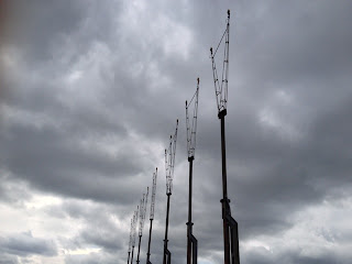
Crossing directly over the road you go over a style and along a private road. I got pretty baffled around here as the map didn't seem to correlate to reality. I firstly followed the road until it went no further and signs suggested police patrolled this area - go no further. Pretty serious stuff. The eerie masts I'd never seen before suggested this was the airport, the map confirmed this. The Leeds Country Way keeps surprising and this appeared like something out of a futuristic, post-apocalyptic world, all very interesting.

Leeds Bradord Airport Masts on the Leeds Country Way
Leeds Bradford Airport Masts
I backtracked and crossed a style now to my right (I passed it on my left heading up the hill). I wasn't much better off now. I kind of moseyed round a touch aimlessly. Until I went with my initial conviction and headed alongside the road until it ended and I carried on through a couple of electric fence gates in the field. This opened up into fields with more horses in, boy they love their horse around here...

The path was a bit hazy round here and I did more miles then necessary. The path actually follows the far side of a hedge that appears in the middle of the field and heads into woodland by the hedge.

I stopped here to examine my feet as I was feeling the pinch in the ball of my feet on my left foot. It was a recurring issue from the last time I wore my Merrell Moam Mid boots but seemed ok.

This was heavy going and parts were boggy at best more like marshy in places and slowed things considerably. Again it was pleasant though. The hiking trail emerged out of the wood opposite Leeds Trinity University.

Woodland on Leeds Country Way
Woodland
The path continues between two hedges between Leeds Trinity sports fields and the campus. When they emerge you should go straight up the hill with the all weather pitches on your left, I didn't I went round them but rejoined the path which heads off to the left.

Leeds Country Way through Leeds Trinity University
Path through Leeds Trinity University
Not 100 yards later there is a turn to the right through a snicket which is the route to take. This then leads into a woodland. The path through here is well marked. Before long you emerge to some fairly impressive views with a bench to soak it in, I had no time to soak anything in due to all the lost miles meandering aimlessly. The path on the wood descends to a bridge which appeared to be by a school.

View from the Leeds Country Way
It was here that, at 4:00 I decided it was time to head home due to time constraints. With the iPod now firing me home and with no wasted miles I did the exact same route albeit without the wasted distance and was back at the car for 5:30, not sure what my average time would have been but the blisters suggested it must have been pretty quick. This part of the Leeds Country Way didn't disappoint - it was superb.


Golden Acre Park on the Leeds Country Way
Walk home through Golden Acre Park

Wednesday 1 May 2013

How to prevent blisters?

This Oxfam Trailtrekker challenge has really led me to seek ways as to how to prevent blisters. The last few long distance walks I've been on for training I've ended up with loads of blisters (more like growths than blisters actually), well I call them long distance walks they were only really 20 some miles so they probably don't fall into the long distance walk bracket but for all intents and purposes I'll refer to anything over 20 miles as long distance (no doubt something the LDWA would dispute).

The blisters I've had have been the most agonising part of the walk and where I've felt my legs can do more the blisters definately can't thus I am embarking on a quest of research to find out how to prevent blisters to ease the pain particularly for this gargantuan yomp we're having a shot at. Any techniques or ideas as to how to prevent blisters must be a bonus on the day.

I've started my quest with a rough search and already came up with what seems to be a good broadbrush start here.

Other "How to Prevent Blisters" posts
Correct footwear to prevent blisters
The secret weapon in how to prevent blisters
Look after your feet to prevent blisters
How to prevent blisters on the day you walk

Monday 22 April 2013

An addendum to my iPhone Walkmeter App vs Satmap Active 10 Review

It crossed my mind once I'd posted the Walkmeter vs Satmap Active 10 review that I had omitted something which was quite crucial. It is with reference to the Satmap Active 10, the Walkmeter review I feel is fair and true to the best of my knowledge.

The Satmap Active 10 however is inaccurate as an out of the box unit. Unfortunately at the outset I found the battery life to be substandard and was only really of use to record/log routes as any attempt to use it as a navigation tool drained the batteries like the fury. Obviously it was great to record certain routes in the wilderness as running on satellite the Satmap Active 10 was never out of service however the Walkmeter did suffer from this being reliant on it's mobile phone carrier signal.
The cure was to buy the rechargeable battery for the Satmap Active 10 which makes it an awesome piece of kit and can thunder on all day long on a lengthy one day hike.

Thursday 18 April 2013

Walkmeter vs Satmap Active 10

So of late I've been using the old iPhone with the Walkmeter app (review here) far more than I've been using the Satmap active 10 (review here). Why? A number of reasons but that's not to say that the Satmap active 10 has been made redundant - no way, its an awesome piece of kit!

So where does the Walkmeter iPhone app trump the Satmap Active 10? Firstly its convenient... The iphone is a handy piece of kit, fair play it's not as robust as the Satmap but as we all know it's compact and lightweight and you barely notice it in your pocket the Satmap, whilst not a brick, is considerably larger and is fairly weighty to take out on the hiking trail. What I like most about the Walkmeter app though is the mapping facility. It writes maps directly to google maps and the facility of emailing these or pasting them into google couldn't be easier. I find it also more accurately details the average pace, time walking etc. along with the pace and altitude graphs. It's perfect (or so I feel but haven't yet come across an app to beat it) mapping and diarising your walks.

The Satmap active 10 will always have it's place however. Whilst I've not yet found a way of swiftly and easily transposing the Satmap active 10 maps to my computer or email I wouldn't dream of being without this on anything other than low level pathways and bridleways. It locates with ease where you are and shows your location on an OS map which is imperative when off the beaten track. As this uses satellites too rather than 3g it never has any reception issue which the Walkmeter does when out of reception. I suppose though that the Walkmeter wasn't specifically designed for this kind of thing whereas the Satmap was and in this field it excels. It is a robust piece of kit too so you know you can rely on it. That said I would never ever suggest relying fully on this, it is always necessary to take a map and compass and more importantly know how to use them.

So in summary - Walkmeter app for low level walking and Satmap Active 10 for off the beaten track. Or put another way, Walkmeter to track and record your progress/route, Satmap active 10 as a navigation tool.

Tuesday 16 April 2013

A walk round Harewood Estate and Harewood House


Harewood House
Harewood House

Still trying to break in my Merrell Mid Moab boots (and to get some fresh air on possibly the most pleasant day of the year yet) we went for a wander around Harewood Estate. Sadly due to work commitments we never made it to the Lake District to do some walking and bag some Wainwrights so local it was. We parked the car in Harewood on the A659 and walked east out of Harewood. This is probably the most unpleasant part of the walk as you end up walking along hte grass verge of the main road with the traiffic passing.

Countryside near Harewood House
Just short of a mile head due south passed a farm (ensure it's not the first turning to the cemetary as this leads to a dead end). You then continue across the field with the impressive Hollin Hall on your left hand side. Passing the fishing pond you leave the field and ascend with a woodland on your right.

Harewood House Countryside
The footpath continues in a straight line until you get to a t-junction where you join the Leeds Country Way in either direction. We went right heading in the direction of Hrewood Estate. Through a gate and down the hill we arrived on Wike Lane. Again walking on the grass verge but with far less traffic it isn't long before we arrived at Harewood estate. For the main part the part of the walk we'd completed so far wasnt the most staggering, between the main roads, through the farm and passed Hollin Hall were very plaesant but time on the roads do detract from it somewhat.

Leeds Country Way Sign

Once into Harewood Estate though the scenery is quite stunning with Harewood House revealing its magnificence fairly swiftly in the distance on the right hand side in the distance and boy is it impressive. The path however carries straight on and into some woodland, the path is clearly obvious here. You head through a gate and soon later over a bridge with a nice water feature to the left. Once over the bridge you continue alond the Leeds Country Way to the left. There is only one path which isn't prohibited which keeps things simple until you're hit with a crossroad. Here the Leeds Country Way heads off to the left, we took the route downhill to the right. Again once you're on this path it winds it's way around and you can see the fishing pond in the distance to your right.

Harewood Estate
Harewood Estate
This path becomes more of a track as it heads into the Harewood buildings. We managed to see a red kite here which was pretty impressive. We then continued back to the main road and back to the car.
Walkmeter had it down as 7 miles but that was taking into account the wrong turn we took to the cemetary at the very start of the walk. A pretty nice meander though, a leg stretch we'll be doing again.


Monday 15 April 2013

Merrell Moab Mid Boots Review

Merrell Mid Moab Boot
Merrell Mid Moad Boot

So then following on from my previous post in the hunt for a lightweight boot and my purchase of the Merrell Mid Moab Boots here is my findings of what joy I came across.

I tried them on and at first try the Merrell Mid Moab is a really comfortable boot. It seems to be really well built and is really lightweight, which is exactly what I was looking for - the best of all worlds! They felt a touch tight to start with but that was no surprise really as I have desperately wide feel anyway (see my post on the Meindl Bernina Boots). The length however was fine so I gave them a shot waiting for them to give a bit as all trainers do, after all the Merrell Mid Moab boots are made of the same stuff, or so it appears.

I went on a 5 mile mosey round the park and whilst they were tight they weren't ridiculous, the inner soles were liking walking on a cloud they they were exceptional. It was nice to get them off however.

After that and with training for the Oxfam Trailtrekker in mind I thought I'd go out and break them in once and for all and set off for a meander up the Leeds Country Way. They started to give me a bit of grief after about 5 miles so I taped the tender parts up with micropore and ploughed on. The long and short of the matter is that when I got back I had a blisters on the sides of my heels where the footbeds are actually too narrow for my feet and whilst there is seemingly enough room width ways for my toes I had a blister the size of my little toe on the end of my little toe, rather a large watery growth at best.

I thought that would really have sorted them so again I gave them another shot the following week once the blisters had settled down to see if they were going to give. Same results, this was only over about 7 miles but still. It's the actual footbed around the middle of the heel of the foot that is too narrow so I feel no amount of breaking in is going to sort these unfortunately. I feel I've given the Merrell Mid Moab's a fair go but after 35 miles they are still giving me grief so I will go back to the drawing board. A pal of mine has pointed me in the direction of the Keen Targhee Mid Boot so I'll give them a shot next.

To surmise I have a friend who swears by the Merrell Mid Moab boot but for my wide feet there is just no way will these boots do, well not in my size anyway. Naturally if I went up a size then they could well work but then I'm nervous that the flex point over my toes will be too far forward and cause me discomfort there. So if you have normal sized feet from a width perspective I think these could be possibly the most comfortable boots you could come across however very very sadly they are not for me.

Wednesday 10 April 2013

More more more of the Leeds Country Way

Leeds Country Way

A much nicer day, I set out on another training walk for the Oxfam Trailtrekker along the Leeds Country Way - a far nicer day this time though. I went for it in my new Merrell Moab mid boots to try break them in but more about that later. Again the same start as the norm and set off through a particularly busy Temple Newsam Park, as it would be on what was the first weekend of pretty spectacular weather, and dare I say it the last for a while. I plodded through the wood in an attempt to shirk the crowds who normally walk up and down the Avenue in Temple Newsam.

The bridleway then skirts Bullerthorpe Lane and emerges not far from Thorpe Park. Rejoining the Leeds Country Way by the M1 I followed the same route through the farm and along the way to Scholes, this part of the route I had already done and was the more pleasant part of the route previously walked. Leaving Scholes via a hiking trail adjacent to the vegetable plots the route heads towards Barwick in Elmet. From here it improved vastly with a more countryside feel.

The route takes you through and alongside various fields which were still dotted with snow - even though it was over a week since we last saw it snow. Not long later the Leeds Country Way arrives in Barwick in Elmet which again is pleasant enough but I'd far rather be walking out of civilisation. I suppose there are plenty of country pubs to benefit from though which is always a plus, more so if you're walking for about 6 or 7 miles, more of a hindrance when you're hoping to walk 20. But Barwick in Elmet is quite nice. You follow the road passed the church on the left with the pub on your right. A left turn leads you out of the village. There's a public footpath which you may be mistaken in taking but by heading down the hill another footpath which is the Leeds Country Way presents itself.

You head out of the village here and over a stream which seemed like a perfect spot for a bit to eat and to micropore the blisters on my feet, blisters are the only bad thing about walking. This leg takes you along the side of a field and leads you over a track where trespassing is prohibited, bit confusing. Skirting a tree line beyond which there was a field of lambs this was one of the nicer stretches of the day, until I came across the A64. This is a treacherous road to cross not only due to the speed of the cars but also as one direction is a complete blind spot. Through Kiddal Wood and you're on the hiking trail to Thorner. Hugging the southern-most edge of the village, by road, then footpath, then road again until it bends to the right you head through the centre of the village. You pass the Mexborough Arms as you cross the crossroads and head out of the village. Through gates and up the hill you arrive in a small hamlet where Oaklands Manor is. On into the hamlet and you can see the yellow marked post which signs the Leeds Country Way. It's only a small hop down the field and you're back onto a road and walking a short hop down to Moat Hall which is the next right hand turn.

At the next opportunity I headed over a style and followed a footpath which turned into a complete bog. Navigable only by crossing make-shift bridges made out of logs. This path emerges into a field and you soon find yourself in Bardsey. Here I consulted the walkmeter and found I was suddenly 12 miles in and I now had to get home. I looked at the map for the most direct route and beautifully discovered that I could maybe shave off a mile or so by just heading in a straighter line then the straight line I'd taken to get here.

I basically backtracked to Thorner along the roads and cut off right before the Leeds Country Way. Walking through Thorner a path headed right before I hit the Leeds Country Way which I took thinking it would reduce the mileage. Which no doubt it did. The path took me into Saw Wood which is attached to Kiddall Wood which I walked through earlier. The path went to oblivion and just seemed to disappear so I just trudged through the woodland until I was close to the A66 then headed east looking for a marked footpath which I duly found.

I then crossed the road and walked down the hill, increasingly concerned at the lack of footpath, I wasn't wrong though as it was once again marked at the bottom of the hill. The hiking trail from here was well marked back to Scholes whereby I followed the standard route back to Temple Newsam park and home. According to the trusty walkmeter on the iphone I'd covered around 23.25 miles which was more than I'd set out for and was pretty pleased with the effort. Hot bath and a homebrew necessary. This was a far nicer stretch of the Leeds Country Way, looking forward to the next leg.


Tuesday 9 April 2013

I'm back! On the Leeds Country Way Hiking Trail

Leeds Country Way

The forecast wasn't great but with my physiotherapy in my head and the Oxfam Trailtrekker in the forefront of my mind I decided to give the Leeds Country Way another shot. I was going to walk from home, through Temple Newsam Park and wind up in a pub somewhere, likely Barwick in Elmet and set myself up in a boozer with a fine mead and call a lift. Which isn't quite how it ended up working out... I figured I'd set out to do about 16 miles but would feel my way through it as it had been a while since I'd been on a walk that far.

So I left home and if was spitting, albeit not too heavy. I walked through Temple Newsam Park and headed in the direction of Swillington. Temple Newsam Park itself is really pleasant. The Leeds Country Way is nowhere to be seen at this point and I'd probably covered 2 - 3 miles before I hit it close to the outskirts of Woodlesford. It started off more pleasant than my previous experience. It winds along footpaths and bridle ways through the outer suburbs of Leeds but passing through the likes of Great Preston (where I think I went wrong) and Kippax do detract from what you expect to be a Country Way as these are not the most pleasant of places. I was trying not to refer to the map too much either as it was throwing it down by the time I got to these places which in itself suggested that I should consult the map more as I should never have been in Kippax itself.

Once out of Kippax though the route takes you down a disused railway where I only came across a couple of cyclists and a couple of dog walkers which was nice, although I'm sure if it wasn't heaving down there would probably have been more traffic.

I then wound up walking into Garforth. Again the route takes you straight through the middle of the town, the surroundings of which you don't expect on a route called the Leeds Country Way. It was whilst walking through Garforth that a thoughtful and observant driver roared through a puddle and soaked me to the bone from the waist down which was far from ideal. Suppose that now meant that I wouldn't be finishing me day in the pub. Not amused!

Once out of Garforth the route heads back into the countryside, accompanied by snow now - which only lasted about 15 minutes in fairness. The route here takes you over the railway and then the M1 heading through a farm and off towards Scholes. The route continues to be marked with the picture of an owl and the letters LCW (Leeds Country Way) which you will see above and is really easy to follow.

Approaching Scholes I still felt pretty ok so I decided to add some miles on and make the yomp back home. It was here that I left the Leeds Country Way and I walked back passed John Smeaton Leisure centre. Through the industrial estate I turned left and when the opportunity arose I turned right and crossed the unmanned crossing of the railway. I then followed a hiking trail in the direction of Thorpe Park Industrial estate. Instead of trudging through suburbia I opted to walk back through Temple Newsam Park to home. I was aching when I landed back, 20.5 miles was the distance according to the iphone walkmeter. Encouraging but still a long way to go.

Again not overly enamoured with the Leeds Country Way but I think the further north I go the nicer it will be. We'll see...


A weekend with the Wainwrights

Blisteringly the opportunity has arisen this weekend to head to the Lake District with some friends - what joy. The destination as yet is not specified but this of course presents the opportunity of walks and Wainwright Bagging. Now however with a pregnant wife the options do become limited as her range is restricted. No matter however walks with Wainwrights somewhere, anywhere in the Lake District is always as awesome weekend. This one falls well as I'm trying to walk miles but with the scenery of the Lake District to benefit from it can't be better. Spring weather pending of course. Decisions decisions decisions...

Monday 8 April 2013

Oxfam Trailtrekker

A chum of mine likes a challenge, well don't we all. He's been wanting to do something big for a couple of years, so we did the Yorkshire Three Peaks, then the National Three Peaks. He was planning to do the Yorkshire Three Peaks on back to back days which would have been pretty heavy. We were looking at having a stab at the Lakeland 3000's but for one reason or another this never happened, probably because we felt the Lakeland 3000's was almost too much. I then recalled some pals doing this beast, the Oxfam Trailtrekker, well it's a beast in my eyes.

The Oxfam Trailtrekker has 3 different levels, bronze, silver and gold, with differing distances around the Yorkshire Dales. So of course if you're going to test yourself you'd might as well go for broke and really fire headlong into it with full commitment. He told me we were doing gold. It's for teams of four, the other two guys he's roped in aren't so sure we can do it, 100km's is a long way. Especially when we've got just 2 months to train for this behemoth of a yomp.

So the training for the Oxfam Trailtrekker starts here, odd to think that 5 months ago I was barely hobbling out of hospital having had reconstructive surgery only to be having a shot at this monster just around the corner. Bring it on. Yeah I'm full of it now, unlikely ill be as bullish after having meandered for 40 miles around the Yorkshire Dales.

Saturday 6 April 2013

The Leeds Country Way Hiking Trail


The Leeds Country Way Map

So I had my anterior cruciate ligament reconstructed in November and have been undergoing physiotherapy since then. It's been pretty intense but ultimately you get out what you put in and the more of a slog I put in now the better the results will be in the long run. As all physiotherapists will tell you the actual operation is only half the battle, the rest is down to the patient and the exercise. 

Living on the outskirts of Leeds I decided to have a look at an ordnance survey map of Leeds to see what there was locally instead of driving the hour or so to the Yorkshire Dales, the North Yorkshire Moors, the Lake District or the Peak District. It would probably be easier on my joints too on the flat rather then up hill and down dale. Whilst it would unquestionably be preferred to walk in Yorkshire Dales, the North Yorkshire Moors, the Lake District or the Peak District the 2 - 3 hour round trip makes it a bit impractical. So looking at the map I stumbled (visually, not literally) on the Leeds Country Way which is a 62 mile route around the outskirts of the city. 

So as part of my physiotherapy I started along the Leeds Country Way from Woodlesford, heading towards Methley with not the best results. I started off along the Leeds Liverpool canal and whilst it was pleasant, it was a touch less than inspiring. It's fairly well marked and this section was all very flat, naturally as it was along the canal side for the main part. I think we did about 6 miles as a circular route. So to surmise, this part of the Leeds Country Way was fairly uninspiring and sadly was too close to suburbia to avoid litter. That said I'll persevere with it as the rest may turn out to be quite different. 
 
Copyright (c) 2010 Roam the Hills. Design by WPThemes Expert
Themes By Buy My Themes And Cheap Conveyancing.